Your browser is out-of-date!
Update your browser to view this website correctly. Update my browser now

Geomatic professionals
since 1994
A team of geomatic analysts, geophysicists and computer scientists, we have been solving data problems for decades. We began in the labs of the Geomatics Department at Newcastle University – since then we’ve built, scaled and licensed the entire GeoSuite Toolkit, working with clients around the world.
Meet the experts
-
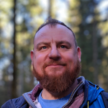
Martin Rayson
Chief Executive Officer
Martin is a graduate in geophysics, which was followed up by a PhD in Survey Sciences, both from Newcastle University. Martin is a geomatics engineer with specific interests in seismic exploration and well bore data management. He has 30 years’ experience in working with seismic acquisition companies and internally within oil companies, including Shell Upstream Americas and PETRONAS. He specialises in geodetic issues related to the preservation of data integrity of all geospatial data used within the exploration industry.
-
Andy Cheetham
Manager - Software Research and Development
Andy is a graduate in computer sciences from Salford University in the UK, and now leads the software development group. Through his time with the company, he has developed a thorough working knowledge of coordinate operations and the architecture of the EPSG geodetic master database, alongside a strong appreciation of the guidance notes published by the IOGP. Andy’s team place a great deal of emphasis on compliance with international data standards to deliver software solutions appropriate to these regulations.
-
Nils Lundstrom
Manager - Consultancy Services
Nils is a graduate at both undergraduate and postgraduate levels in computer science and engineering, and has worked with geospatial data in the aviation and hydrocarbon exploration industries. Nils manages the consultancy team, working closely with our clients in solving the many data problems associated with all geospatial aspects of coordinate reference system integrity, particularly within software applications. He is passionate about data integration, as well as forensically examining vintage data to explain causes and results. Nils is currently involved with numerous E&P companies to realise all aspects of geodetic frameworks, alongside implementing tools that enable increased automation and control within workflows requiring geospatial integrity.
-
Sam Webb
Geospatial Data Analyst
Following the completion of his PhD with the Geodesy group at Newcastle University, Sam joined us in 2015. Based out of the UK office, Sam’s role as a geospatial data analyst sees him working with our clients to ensure that geospatial integrity is at the many different stages of exploration and production. The role encompasses the QA/QC of datasets, the robust management of spatial data within corporate networks, and the delivery of geospatial training courses.
-
Abby Punshon
Geospatial Data Analyst
Abby has been part of the geospatial team in the UK office since joining Geomatic Solutions in 2014, following the completion of a Geomatics degree from Newcastle University. During her time with Geomatic Solutions, Abby has been involved in assessing datasets from across the world. A wealth of experience has been built up from dealing with the complex variations in geodetic parameters between these global datasets. Abby is constructively involved in developing workflows aimed at handling and preserving the geospatial integrity of our client's datasets.
-
Matt Edge
Geospatial Data Analyst
Matt is part of our UK based geospatial team, providing support services throughout the exploration cycle to our clients in the energy industry. Since joining in 2017 after graduating with a Geomatics degree from Newcastle University, Matt has furthered his competencies by undertaking training in the world of wellbore surveying alongside developing his awareness and understanding of the intricacies of geospatial data management within the industry.
-
Ika Muhamad
Geospatial Data Analyst
Ika is a graduate in Survey Science from University Technology Malaysia and worked offshore for 8 years in exploration survey before joining the Malaysian team in early 2019. She was involved with geohazard and 2D seismic surveys as a surveyor and CAD/multibeam processor in the Asian region, before moving onto a navigator role working offshore South America, Canada, UK and Europe. Ika is part of our geospatial team, assisting our clients with their geospatial data management.
-
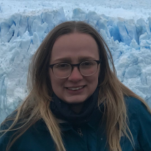
Yean Yean Tee
Geoscientist
Yean joined as a part of our geospatial team in 2019 after graduating from University Technology of PETRONAS with a degree in Petroleum Geoscience. Based out of our Kuala Lumpur office, Yean has been working with our clients to maintain their geospatial data integrity through wellbore survey management and well position verification.
-
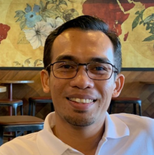
Khairul Ibrahim
GIS Analyst
Khairul joined Geomatic Solutions in April 2018 as a GIS analyst in the geospatial team, based in Kuala Lumpur. He is a graduate from MARA University of Technology in Malaysia, with more than 10 years of experience working with GIS and geospatial data management within oil and gas companies.
-
Hafizah Ghani
GIS Analyst
Hafizah has a background in Geoinformatics from Universiti Teknologi Malaysia and completed her master’s degree in petroleum Geology from University Malaya. She is experienced working with Geospatial data including LIDAR data and GIS Mapping. Hafizah joined the Malaysian team in February 2022 focusing on GIS data analysis and well verification.
-
Aifa Norfildaos
Junior Geospatial Analyst
Aifa graduated from Universiti Teknologi MARA in 2020 with Bachelor of Surveying Science and Geomatics and joined us in March 2022. She has previous experience of managing geospatial data and creating web mapping using ArcGIS Enterprise. Aifa is based in our Kuala Lumpur office and focuses on seismic positioning QA/QC


Be confident in your data
Our software and services
support you through every stage.
United Kingdom
+44 191 308 2484
enquiries@geomaticsolutions.com
Get in touch