Understand your geospatial data Improve your decisions
The quality of your data will vary, especially with vintage. However, the quality of your decision making should not. At Geomatic Solutions, we strive to ensure your geospatial data is representative of where the upstream activities actually happened. This will greatly enhance business decisions made from the data.
Is this familiar to you?
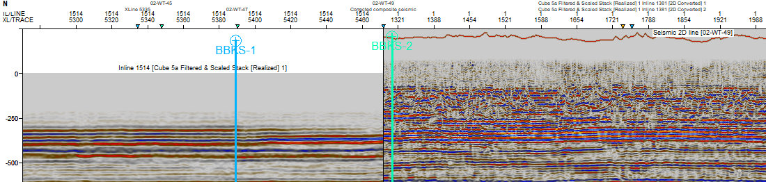
Before mis-tie
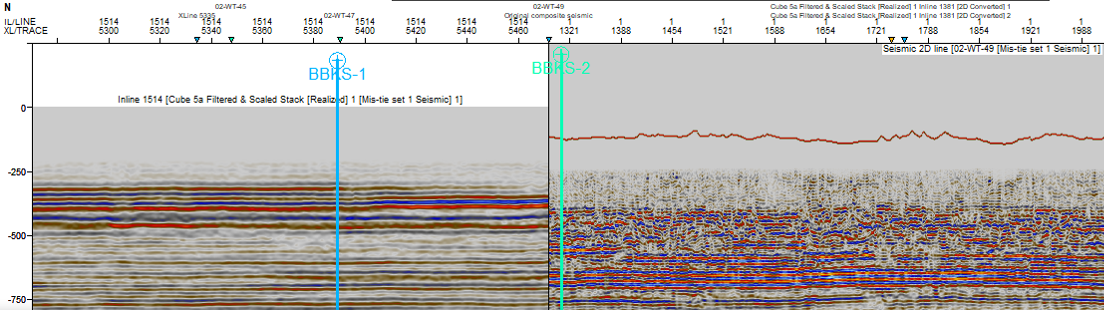
After mis-tie
Seismic misties often arise from incorrect Coordinate Reference System (CRS) selections. Addressing these issues promptly is crucial to prevent larger complications down the line. Geomatic Solutions can help you resolve these issues effectively, ensuring accurate geodetic selections and minimizing seismic misties for smoother operations.
Be confident in
your data
Our software and services support you through every stage of data life cycle.
hello@geomaticsolutions.com